


Pre-Even Image: Satellite image dated August 22 nd, 2022 of the Casa Ybel Resort – Credits @AirbusSpace
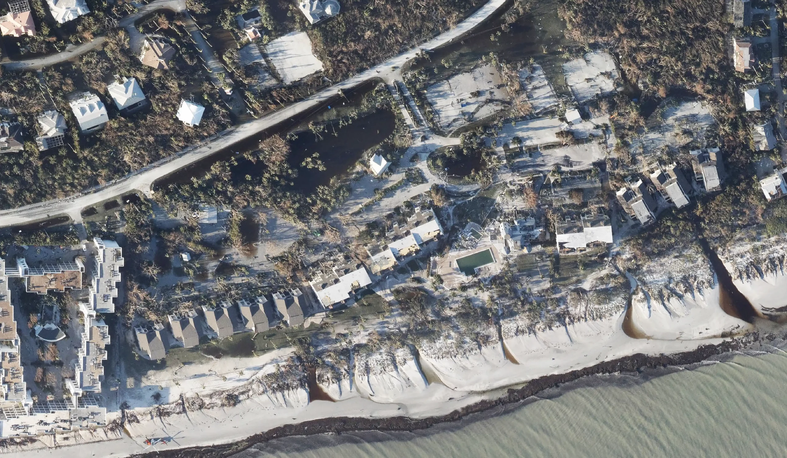
Post-Event Image: Aerial image dated September 30th, 2022 of the Casa Ybel Resort – Credits @ NOAA
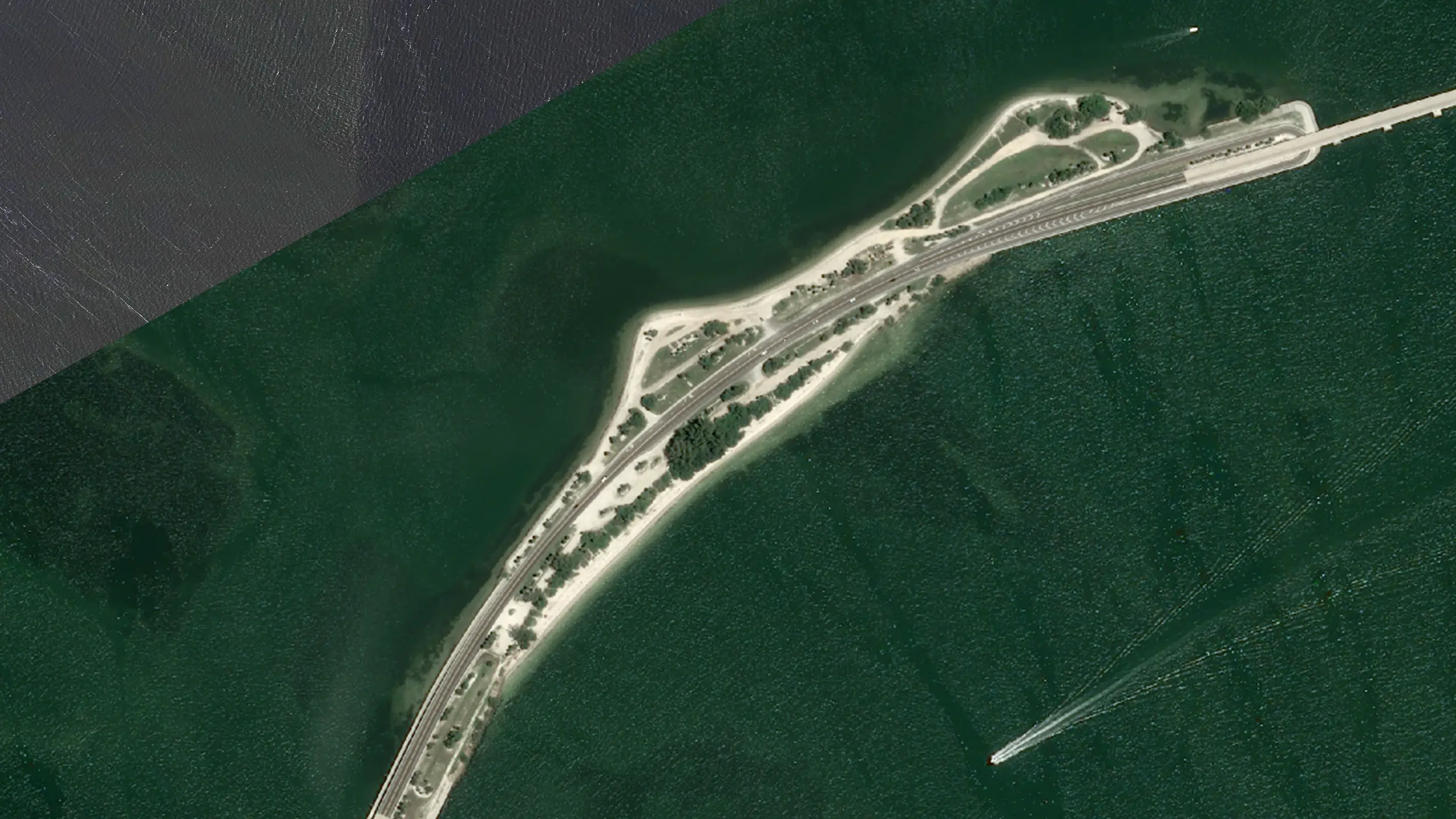
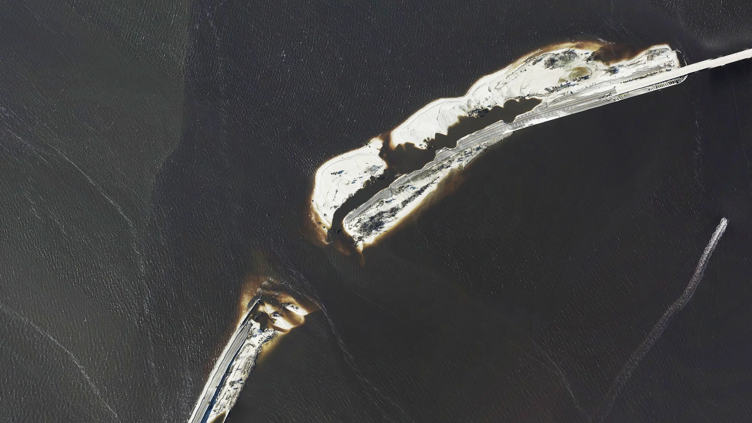
Comparing pre- and post-loss satellite images to assess the extent of damage and verify the accuracy of claims. Identify potential fraud through inconsistencies between the claimed damage and actual images of the asset.
Regular satellite surveillance of large commercial properties or infrastructure projects helps identify changes in risk factors, such as construction activities, environmental conditions, or potential hazards.
Pre-Event Image: August 22nd, 2022 of the Sanibel Causeway – Credits @AirbusSpace
Post-Event Image: September 30th, 2022 of Sanibel Causeway – Credits @ NOAA
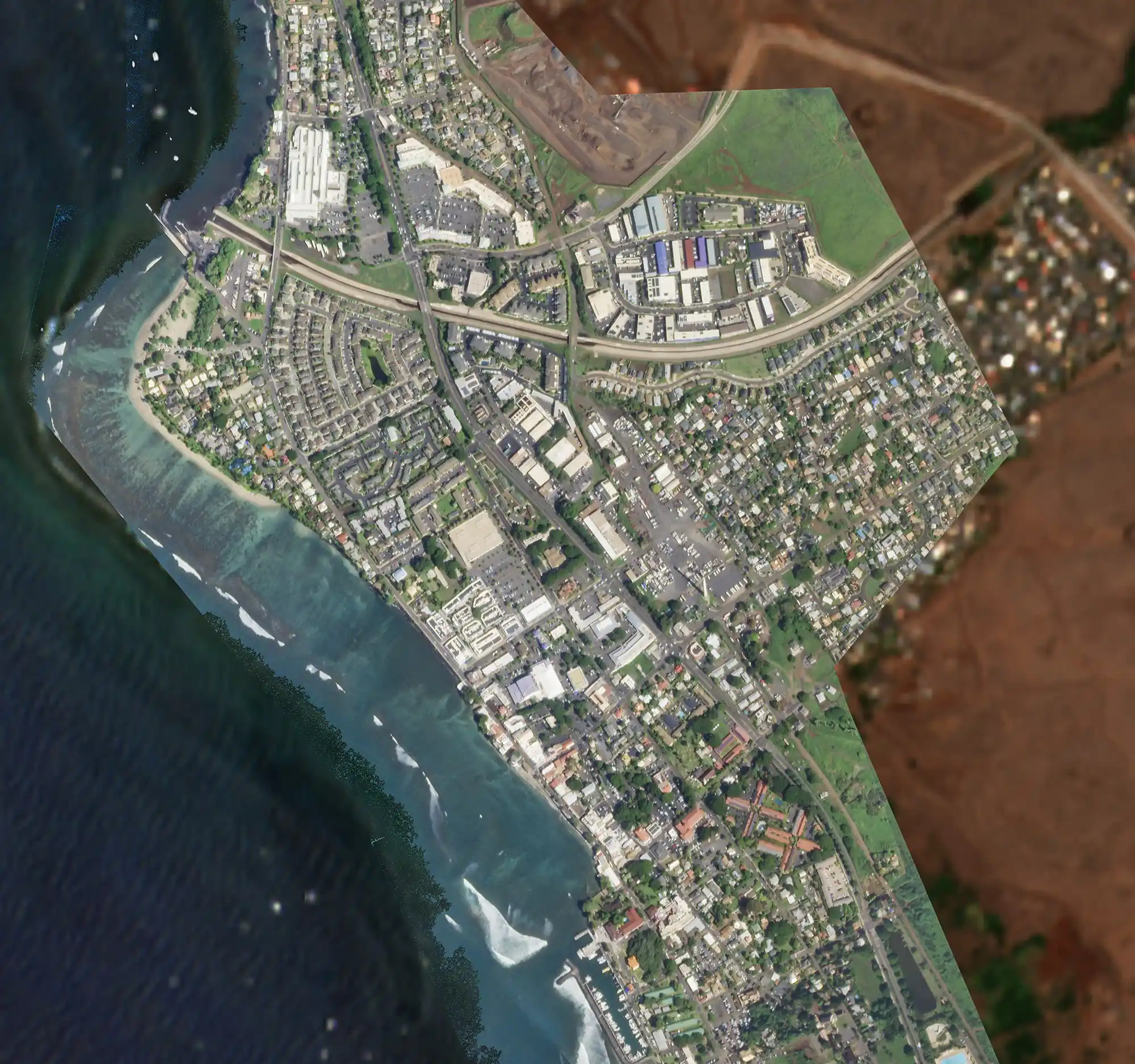
Pre-Even Image: Planet Labs satellite imagery of Lahaina city on February 02nd, 2023.
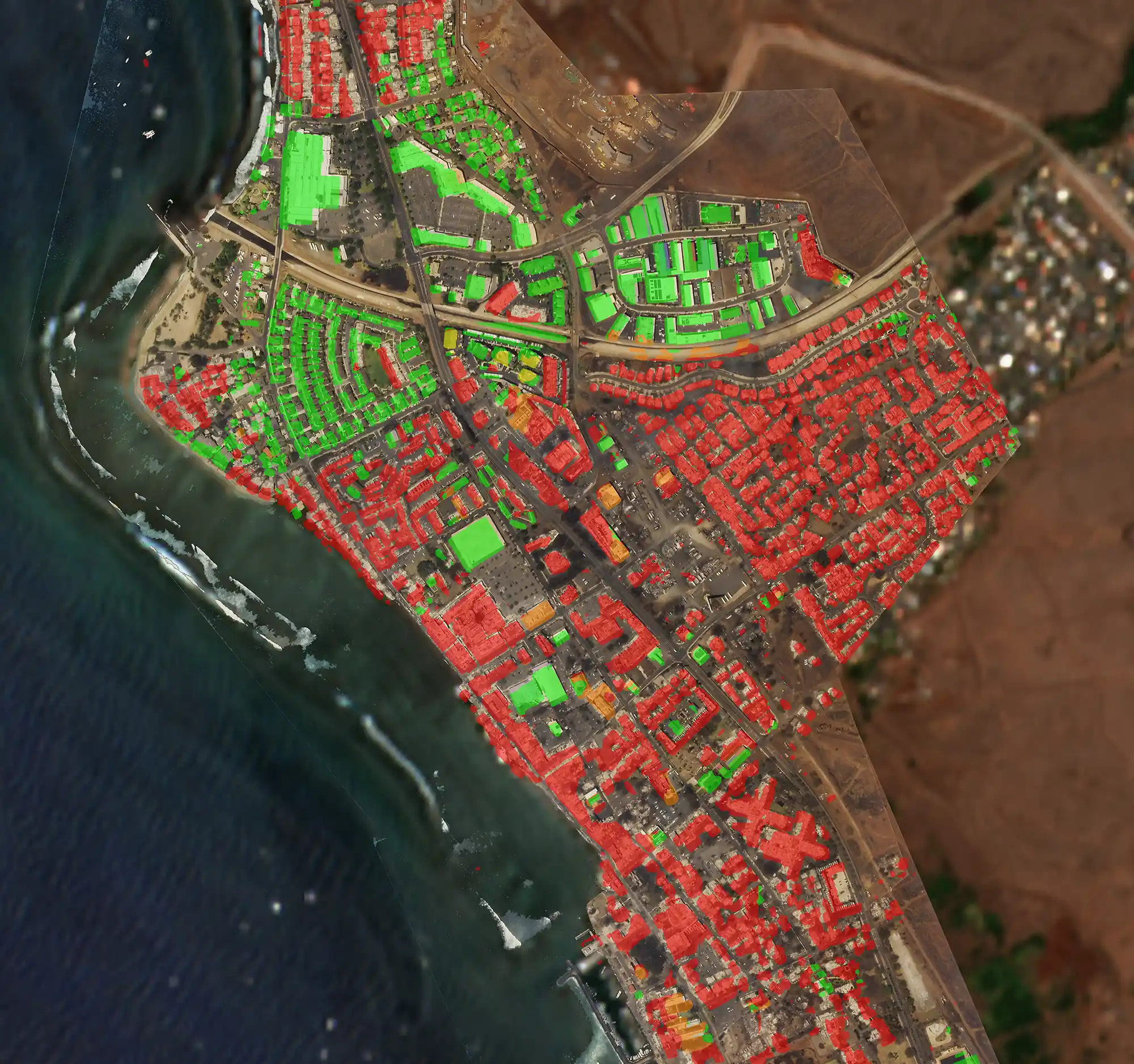
Post-Event Image: Planet Labs satellite imagery of Lahaina city, damage overlay on August 15th, 2023
During natural disasters or large-scale events, satellite imagery can provide real-time data on the affected areas. Insurance companies can use this information to assess the extent of the damage, estimate losses, and allocate resources more effectively for disaster response and claims handling.
High resolution satellite imagery help insurers assess risks more accurately and make more informed underwriting decisions. Custom reports combine imagery with analytics to provide a unique view of a property and its proximity to potential hazards.
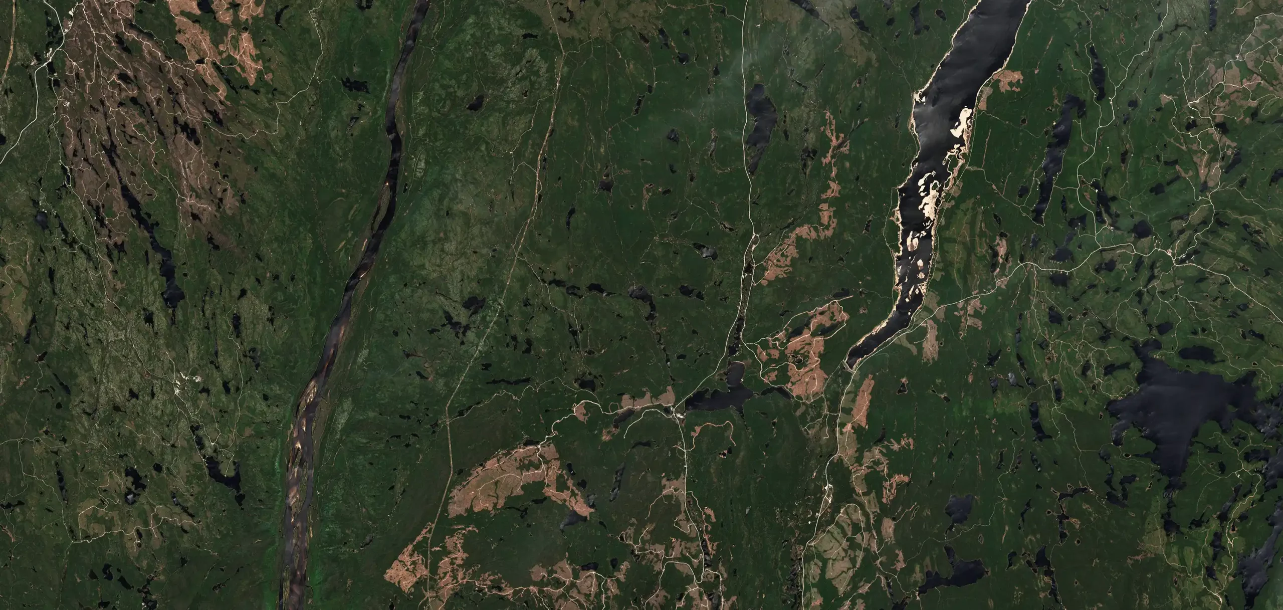
Canadian Wildfires: Sentinel 2 satellite image – 30th May 2023
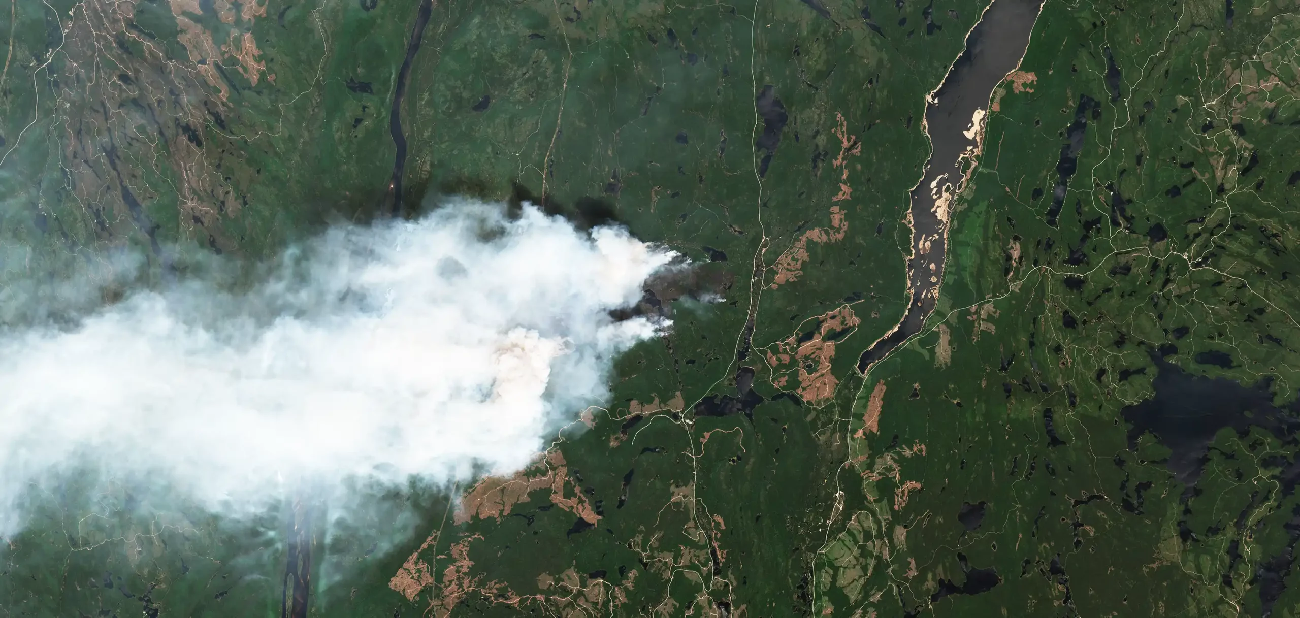
Canadian Wildfires: Sentinel 2 satellite image – 04th June 2023